Challenges: A main challenge is to improve forecasting and hazard assessment of a range of natural hazards with both local and global implications. Natural hazards, such as extreme weather, snow avalanches, landslides and earthquakes, pose a threat to populations and infrastructure around the world but also in the Arctic. The ice masses of the Arctic constitute several hazards, for example as a primary source of global sea level rise through mass loss and as producers of icebergs representing a hazard to ships. The likelihoods of other natural hazards are likely to increase with climatic changes in the Arctic. For example, melting of snow and ice and thawing of permafrost may expose or destabilize slopes and thereby increase the risk of landslides.
Work in INTAROS is addressing, among other hazards, extreme precipitation forecasts in order to improve snow avalanche forecast models; improvements in the calculation of sea level rise due to ice loss in the Greenland ice sheet and Svalbard glaciers; methods to separate solid iceberg production from the total marine mass loss of selected glaciers; improved earthquake monitoring by placing monitoring stations on the ocean floor; and improved landslide monitoring by combining remote sensing data with land-based seismological data.
Results obtained in INTAROS: The studies highlights that both satellite observations and in-situ observations are needed in order to map natural hazards in the Arctic. Areas that have been addressed are e.g. snow avalanche forecasting, sea level rise, iceberg production, earthquake and landslide monitoring. And especially for events such as landslide satellite observation are very useful to locate hazardous areas in the space domain, one must rely on in-situ observation to get precise locations in time.
The data collected during the INTAROS project will be made available through the INTAROS iAOS (https://catalog-intaros.nersc.no/) and will be included in future mapping of the natural hazards in the Arctic.
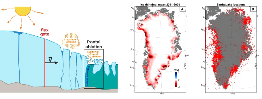
Left: Frontal ablation leading to iceberg calving: Centre: Mean elevation chnage rate of ice surface from 2011 to 2020. Right: Location of all registered earthquakes in Greenland from 1972 to 2020. Copyright: GEUS.
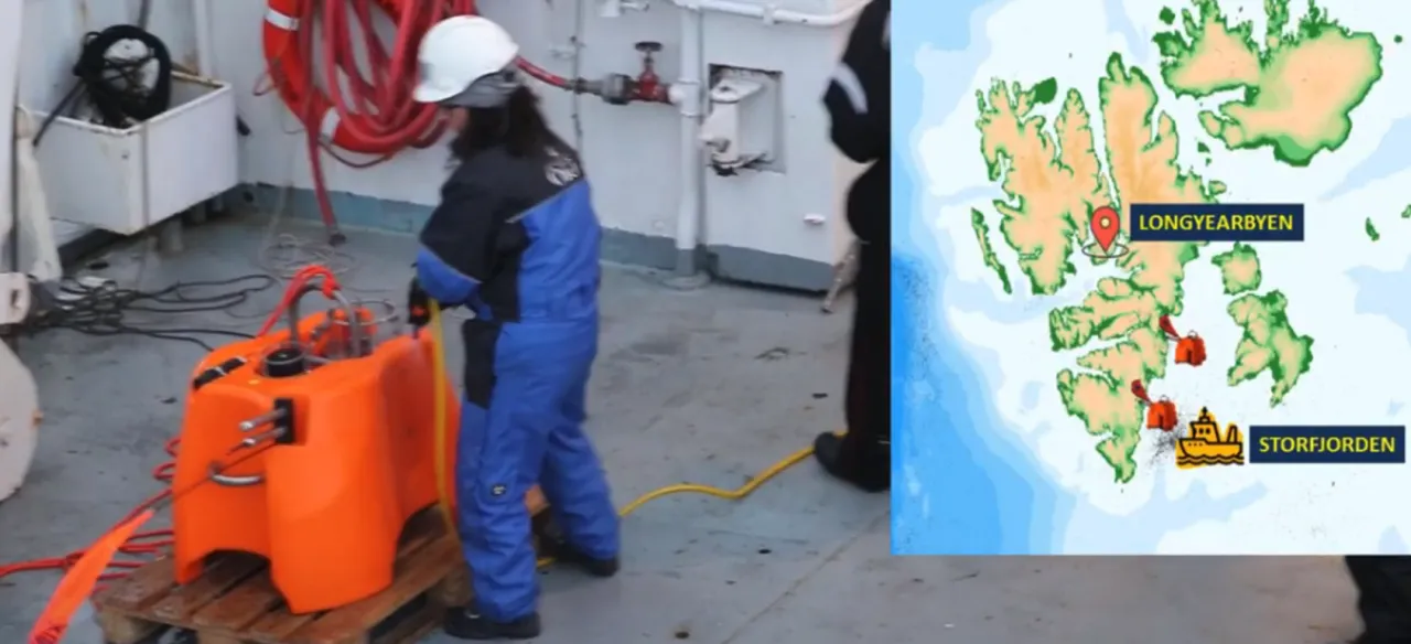
Deployment of Ocean Bottom Seismometers (OBS)in Storfjorden for monitoring of events with a seismic signature. The seismicity in Storfjorden incrreased after the a magnitude 6.2 earthquake in 2008. Therefore improved monitoring with OBS instruments in this region is of great interest. Copyright: UiB.
Video from OBS recovery and deployment cruise in Greenland Sea and Storfjorden in August 2019: https://www.youtube.com/watch?v=U6ch88KY9Dk